10 reasons why you should be using Maritime Weather forecasts
 Written by
Asma Toroman
Weather Product Marketing Manager at Spire
AIS fused with weather data through machine learning contexts is showing promise for applications driving improved fuel consumption and emissions.
We at Spire are often asked about the value of maritime weather forecasts. Weather affects just about every aspect of the maritime industry, from navigation strategies to fleet management, operations at ports and offshore facilities. Some specific questions we get are:
- “How can maritime weather forecasts reduce our costs?”
- “When do enhanced maritime weather forecasts become necessary?
- “We provide services/applications to maritime companies. What value can we provide by incorporating maritime weather forecasts into our services?”
Let’s look at some proven ways that maritime weather forecasts can:
- reduce costs
- improve performance
- streamline decision making
Discover our free Maritime Weather demo tool
Preview our trusted open ocean weather forecasts, including wave data, alongside real time vessel positions.
Reduce fuel usage
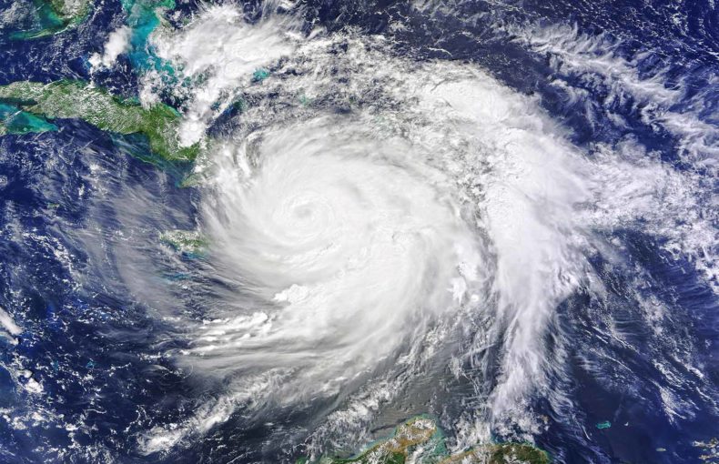
Fuel is typically the top cost for maritime transport/shipping companies, generally comprising 50-60% of operation costs. As a maritime shipping operator, you are under pressure to optimize routes and minimize delays caused by bad weather. Reducing fuel usage is also paramount to meeting emission standards; thereby also having a positive impact on your carbon footprint.
Besides avoiding extreme weather, there are many opportunities to adjust routes based on up-to-date data on currents, winds, and waves. All of these, every day, add resistance to ships traveling through the water and can contribute to extra fuel costs. These are often under-estimated just because they’re so common. However, real-time route optimization taking these into account can lead to significant fuel savings.
Spire addresses the number one problem businesses will face in the next 100 years – our ever-changing climate.
John Lusk
VP and General Manager at Spire Global
Share on Facebook Share on Twitter Share on LinkedIn

Reduce downtime
As a shipping/transport company, you can use Maritime weather forecasts to plan for weather patterns and allow for adjustments to speed and route several days out (route planning). Moreover, you can make changes on-the-fly as the weather changes.
Let’s look at an example of a ship that spends an extra day at sea. As a result of having to avoid a storm and bad planning. This can result in:
- An extra day of fuel cost (possibly tens of thousands of dollars).
- An extra day of crew pay.
- Additional fees from ports and operators.
- Missing schedules, which may lead to additional lost time and money.
Saving as little as 2-3 days per year thanks to maritime weather forecasts is definitely worth the investment.
Improve e-navigation
Just like we have GPS apps that allow us to avoid heavy traffic in our cars… Why shouldn’t we have the same for ships?
We plan to delve into this topic further in a future blog but let’s touch on the basics.
The 2 key datasets necessary for intelligent and dynamic routing (or e-navigation) are ship tracking (AIS) and weather. Key goals of e-navigation are to improve safety, provide improved ETAs, and situational awareness. Up-to-date weather forecasts help you improve in-the-moment decision-making and increase efficiency.
Understanding Maritime Weather forecasts, for both current and future states, play an important role in the development of marine e-navigation and autonomous shipping.
Furthermore, you can fuse and analyze historical weather with ship tracking data to develop intelligent neural networks and routing engines. These are exciting times for maritime businesses!
Reduce disruptions
For manufacturers, a supply chain interruption can be very costly. One sudden disruption can cause a chain-reaction subsequently leading to a near-standstill of a large and complex manufacturing process which can, in turn, have ripple effects on customer confidence, perception, and stock price.
You are more likely to avoid unplanned disruptions when you make maritime weather forecasts an integral part of your workflow
Moreover, by planning ahead for extreme weather, you could, for instance, avoid delays due to storm-avoidance or crowded ports/canals.
Some supply-chain disruptions stem from in-transit damage to goods. The latter can be caused by storm-related shifts in cargo, or to moisture/sweat due to sudden changes in humidity. Better planning for weather helps avoid these disruptive causes too.
Navigate treacherous areas
There are geographical regions of the world that are known for extreme winds, extreme waves, extreme currents, extreme precipitation, icy conditions, and/or extreme fog. Worse, some of these areas are in remote locations that are under-observed by most weather forecasting services. For any organization operating ships, these areas can cause all sorts of issues including; safety risks to crew, damage to the ship, equipment, and cargo, and lost time.
For areas known to be treacherous (like the Tokar gap), it can be especially valuable to have accurate high-resolution maritime weather forecasts. A reliable forecast with better global coverage (no blindspots) allows you to make real-time adjustments as conditions change. The lower the resolution or frequency, the greater the chance that a sudden important change in conditions will be missed.
Lower risk of injury or damage
Better maritime weather forecasts can help you avoid injuries to crew/passengers, and avoid damage to the ship and its equipment.
Precise weather forecasts can also help companies and rescuers respond better when weather emergencies happen.
For example: knowing up-to-date conditions around a storm system can help you make decisions about whether to send out another vessel or to wait. As an emergency/rescue response organization, you may also want more detailed maritime weather forecasts with global coverage.
Besides the direct costs of injuries or damage, there’s also the potential for reducing insurance costs. By using lessons learned to improve risk assessment and security measures.
Indeed, ship damage and accidents do not only occur in collisions. There are a number of other ways that ships can be damaged and the crew can be hurt and, weather is a common factor. Here are two studies on ship accidents and their causes:
- Study on global ship accidents and the sea states causing them.
- An analysis of wintertime navigational accidents in the Northern Baltic Sea.
Analyze and investigate incidents
Investigators, insurers and even investors are improving their practices and costs management thanks to data sharing.
Having access to reliable weather forecasting can help you understand why things went wrong. You might want to study your crew’s decisions during extreme weather. Or even review route planning decisions made by your navigators or a third-party service.
These kinds of post-mortems serve an educational purpose, in order to improve your budget planning, operations, and processes. Similarly, they can be done in the course of an investigation, to determine fault or legal responsibility, or to prove due diligence.
Weather data may be helpful for insurance companies, or any company that requires risk analysis and post-incident investigations.
Big Data sharing and fusion make it much easier to analyze data pertaining to a particular case or to compare to similar incidents. Each new case sets a precedent or benchmark, while also improving future practices.
Improve safety on offshore facilities
When you operate offshore facilities like oil platforms or wind farms, having access to high-quality weather forecasts can help you optimize operations. Crew schedules and maintenance can be scheduled at times when it is safe to work. Managers can make better data-driven and defensible decisions about when to stop the work or when to evacuate.
Better plan port operations
Better weather predictions can help maritime infrastructure owners and managers prepare for extreme weather. One big benefit: you can better foresee when storms will cause pre-storm traffic slowdown and post-storm traffic surges. Better weather forecasts can help you create storm strategies to drive efficiency across all operations.
Add value to Maritime Intelligence Applications
Service/software providers are often looking for ways to expand their offerings. Therefore become more of a “one-stop-shop” for their maritime customers. If you are one of the following you may find value in adding new and/or better weather forecasts to your apps/services:
- Logistics/transportation management companies
- Automatic ship navigation software
- Route optimization service providers
- Ship management software providers
- Supply chain tracking application providers
- Financial market analysis service providers
- Risk management service providers
Did I miss any potential maritime weather forecast use-cases? Let me know
Learn more about our Best-in-class weather data:
Read about Spire Forecast (our weather offering) on SpaceNews.com.
See some Spire Forecast features and use cases.
What’s next?
Do you want to get ahead of your competitors, and lead digital innovation in Maritime ?
You can start by integrating maritime weather forecasts into your workflow, and we can help.
Most organizations know that they need maritime weather forecasts, but few are focused on optimizing the quality of that data. Moreover, there is always room for improvement in how we make use of that data. With more data sources being used every year, and more maritime services becoming digital, it is now paramount that we learn how to effectively source, manage, and use data.